Dyrhólaey is a small peninsula in the south of Iceland with a lighthouse and views of the surrounding areas. In the surrounding of the peninsula, you’ll find a basalt arch, the black sand beach Kirkjufjara… It’s a great spot for bird watching. Dyrhólaey is located close to the town Vik.
The Dyrhólaey Peninsula
Our initial plan for our visit to the Dyrhólaey peninsula was to drive to the lighthouse. We left the ring road and drove on road 218 for about 5 minutes and reached a junction where we had to turn right. But as we got to the junction we saw a sign there saying the road to the lighthouse was steep and only recommended for 4×4 vehicles.
The road is uphill, quite a climb and is bumpy. We only had a regular car so we decided to continue straight and drive to the parking lot east of the peninsula. This parking lot is marked with Dyrhólaey View Parking Lot and WC on Google Maps.
Viewpoint Reynisfjara and Arnardrangur
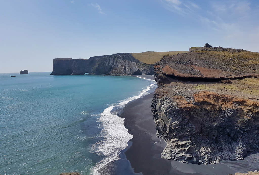
From the parking lot mentioned above, you have great opportunities to explore the area. For example, you can take the trail from the parking lot and walk towards the east. From there you’ll have a great view of the black sand beach Reynisfjara and the basalt stack on the beach, Arnardrangur.
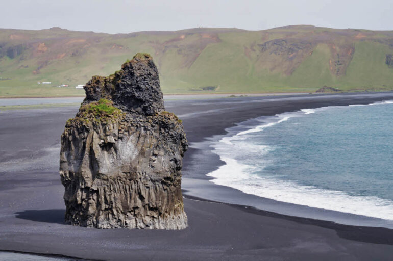
The view from there of the black sand is really impressive. You can take photos with a mobile phone, but to zoom in well on the Arnardrangur basalt stack, we recommend a camera with a zoom lens. You can also walk to Arnardrangur from the Reynisfjara beach.
For details, check our article: Reynisfjara black sand beach
Dyrhólaey Basalt Arch
Another great thing to see at Dyrhólaey, is the basalt arch. This arch is located on the east of the parking lot, where you also have the view of the Reynisfjara beach and Arnardrangur. The basalt arch is an arch above the sea. There isn’t much more that I can tell you about this arch, just that it’s impressive and it’s fenced off so you can’t walk on it.
Kirkjufjara Black Sand Beach
Kirkjufjara beach is another black sand beach in Iceland. This beach is located along the shores of the Dyrhólaey peninsula.

We couldn’t go to the beach itself as the access to the beach was closed. There was a sign at the blockade warning tourists of the potential dangers of the area. As a result, the beach is closed for visitors now as a security measure. We’ve read that the access to the beach is closed since 2017. The dangers are twofold and explained below.
Dangers of Kirkjufjara Beach and why it’s Closed
Deadly Sneaker Waves
First, there are deadly sneaker waves that caused deaths in the past. How sneaker waves are formed isn’t known for sure, but they assume those waves are created when many waves of the same speed come together. They then form a new single wave, that’s much faster and taller than normal.
In the video below you can see such a sneaker wave and the impact it has on the people at the beach. The video is recorded at another beach in Iceland, Djúpalónssandur beach.
Rockslides at Kirkjufjara Beach
Secondly, the sign says that rockslides happened in the past and that further rockslides were likely to happen. To clarify, the sign quoted a news article of 2015. This posted news article can be found below.
November 12, 2015
Recently large parts were torn off Dyrhólaey’s cliff. Massive rocks fell onto the beach. New cracks are constantly emerging on both sides of Dyrhólaey island. Currently the Met Office is evaluating the safety at Dyrhólaey. Further rockslides are likely; hence the environment agency of Iceland warns people off going down to the beach.
Dyrhólaey Lighthouse
If you do have a 4×4 vehicle, you can take the road to the lighthouse. From the lighthouse and the nearby area, you have a spectacular view of the area. If you don’t have a 4×4, you can also drive to the parking lot as we mentioned above, and hike from there to the lighthouse.
If you look at the last picture of this article, the lighthouse is located behind the tongue of land that you see in the back of the picture. Dyrhólaey is the arch that you can see if you look closely. The hike to Dyrhólaey is about 1 km (0.6 miles) one-way. The Dyrhólaey lighthouse is slightly further away. This area can be quite windy, so if you want to go there, dress appropriately.
Leave a Reply