
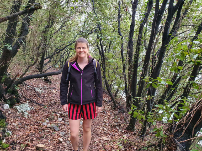
Yesterday we arrived back on the mainland of Croatia, where we did a hike from Labin to Rabac. Today the weather wasn’t that good. In the morning it was raining a little, so we decided to go for a walk around the village of Duga Luka. On this trail, there were some opportunities on small beaches to have a swim if the weather would improve. So an ideal choice.
Drive to Duga Luka / Prtlog
Duga Luka (also called Prtlog) is a small village near the coast, in Istria county, located on a small peninsula. Fewer than 50 people live in this village, but there are some vacation homes and villas for rent. Duga Luka isn’t far away from where we stayed in Labin. The drive was under 15 minutes, so it was really convenient. Also from Rabac, the drive isn’t that long.
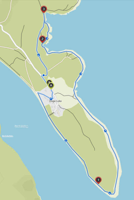
We parked our car at a parking spot next to the road (location on Google Maps) and started our hike from there. We took our swimming clothes with us, in case we’d decide to go for a swim. If you scroll down to the Prtlog map, you can see the parking location marked with A.
Hiking around Duga Luka
From the parking lot, follow the road further into the village. When the road splits, keep right and follow the road for a short while until you can turn right again, in the direction of the sea. Continue on that path until you reach the sea and then go left. From now on you’ll follow a road next to the anchored small boats lying on the sea.
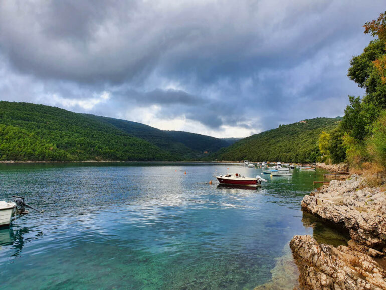
After a bit, the trail next to the sea stops and you go slightly further away from the coast. In the next section of the trail, you’ll hike through some trees that have a black trunk. The trees are covering most of the trail, so it’s an unusual sight, but a nice change.
The Peninsula Duga Luka
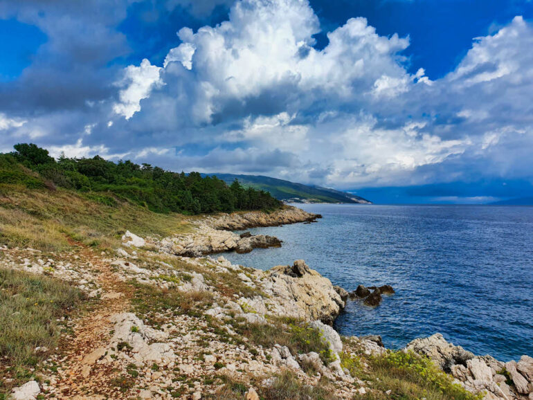
After passing through the black-ish forest, we ended up at the point of the peninsula of Duga Luka. From here you can see the town Sveta Marina, Raša on the west, and the island Cres on the south.
After taking in the view, we continued along a coastal path in the direction of the viewpoint Meeresblick (number 2 on map) and Plaža Mali Portluk (Prtlog beach, number 3 on the map). From here on the trail is always next to the sea, so it’s really nice 😎.
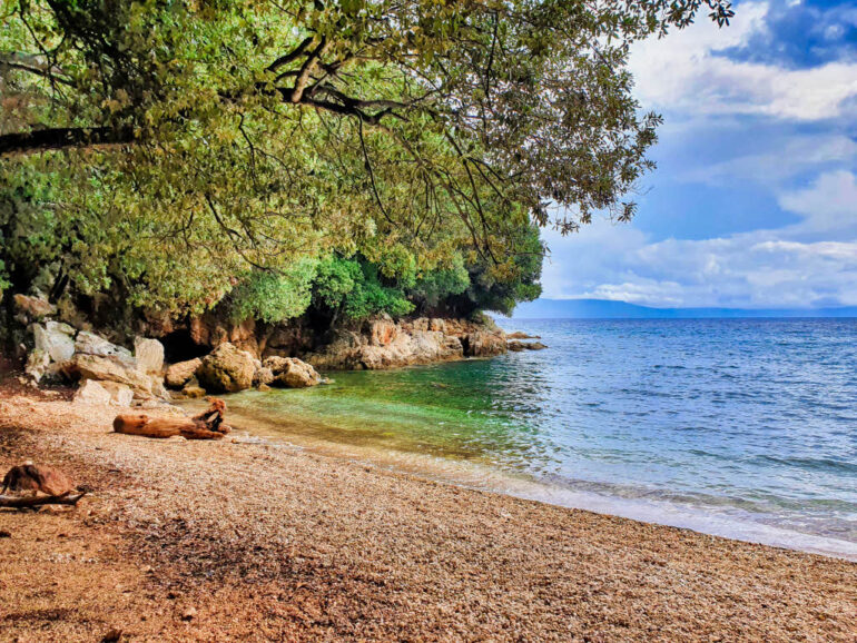
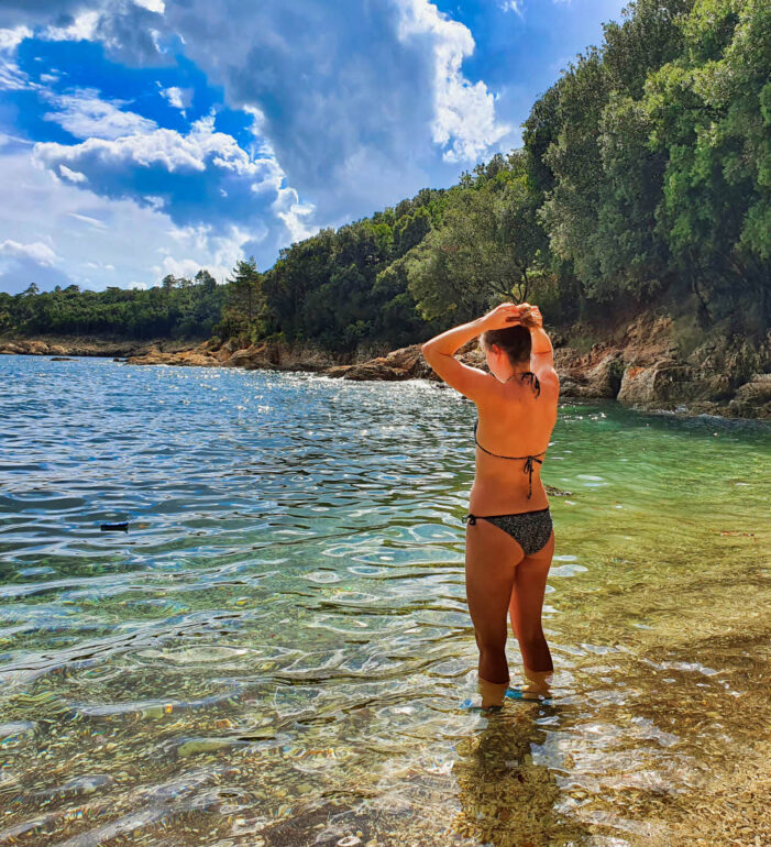
Plaža Mali Portluk – Prtlog Beach
After following the hiking trail next to the sea for about 30 minutes, we arrived at the beach Plaža Mali Portluk. The Duga Luka beach is quite small but it has something wonderful. The beach is located in an inlet. The soil is brown, the trees growing all around the beach and the watercolors are magnificent. You can see for yourself in our picture below!
We put on our swimming clothes and went for a swim. After a few minutes in the water, it started to rain, but it was hot so it didn’t bother us. We stayed in the water until the rain had stopped and then went out to dry up and put on our clothes again.
Back to Duga Luka
After going for a swim, we continued the trail back to the parking lot where we left our car (point A on the map). This last section of the trail is a dirt road that you can also do by car. So if you just want to visit the Duga Luka beach, Plaža Mali Portluk, you can do this as well. In this case, when driving to Duga Luka, take a left behind the recycling containers of the village. You’ll then have to drive a brown dirt road for 5 to 10 minutes.
When we arrived back at our car, we drove back to Labin. We went to the supermarket, bought lunch and ate. In the afternoon we set off for a walk around the Rabac beaches.
Duga Luka Hiking Map
Below you can find the map of our hike. The total hiking time of our tour was about 2 hours as we took it easy and took quite some pictures. The planned hiking time is 1h and 10 minutes. The total trail is 4.1 km or 2.6 miles.
We’d recommend this trail as it’s a short trail, with nice sights along the way and a good and calm beach to swim.
Pin our Article
Like our article, consider sharing it on Pinterest to support our blog.


Leave a Reply